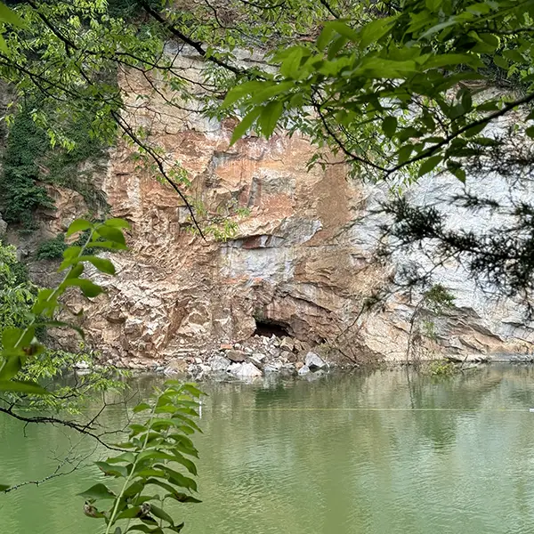
Rockfall Gives UT Geology Class Something to Talk About
News

Rockfall Gives UT Geology Class Something to Talk About
by Randall Brown
First-year students studying geology in the Department of Earth, Environmental, and Planetary Sciences (EEPS) this fall will get a first-hand look at a geological event that took Knoxville by surprise this spring.
Dozens of people were enjoying a sunny Saturday on May 25, swimming and floating on the water at Ijams Nature Center’s Mead’s Quarry when a section of the rocky cliff face on the back side of the quarry unexpectedly collapsed into the water and sent a 10-foot wave pulsing across the lake.
Thankfully, only a handful of minor injuries occurred as swimmers were jostled and people on shore scrambled for safety, with only one person requiring non-critical hospital attention. Ijams closed access to the quarry area for two weeks while geologists from the Tennessee Geological Survey inspected the rock wall’s stability. They reopened the area on June 7 after expanding the lake’s “no-go” zone along the length of the cliff.
Jacob Benner, distinguished lecturer, and Jordan Burkey, lecturer, regularly lead field trips to Ijams as part of EEPS 101 classes. Next fall’s classes will get to see the geologic aftermath of the rockfall.
“We take 300–500 EEPS students to Ijams during one week each semester to cap off their experience in the course,” said Benner. “It’s a great local spot to help students crystallize some fundamental geological concepts. Next time we visit, we’ll point out the rockfall scar and have them brainstorm about potential causes given what they have learned about our local geology.”
What Put the Rockfall in Motion?
EEPS Professor Emeritus Robert Hatcher Jr. points to a conflagration of pre-existing conditions and recent natural activity to explain what could have caused the cliff to collapse.
“There are several different kinds of landslides and there are two sets of factors involved: Factors that favor landsliding, and triggers that set them off,” he said.
Hatcher believes the over-steepened slope of the quarry wall combined with fractures in the rocks that were parallel to the slope set up the conditions for heavy precipitation to oversaturate the area. Rains added weight and lubrication to these potential weak spots.
“The larger-than-normal amount of rainfall we have had this spring was likely the trigger,” said Hatcher. “This is my best guess without any field observations.”
The state’s official geologist also pointed at recent heavy rainfall as a triggering factor, plus the outside possibilities of small earthquakes and the long-ago history of dynamite blasting that created the quarry.
Close-up Peek at Tennessee Geo-History
Mead’s Quarry was once a source for the famous “Tennessee Marble” used in many monuments and structures in the past. The EEPS 101 field trips learn about this history along with geological concepts.
“In the rock formations along the Ijams River Trail boardwalk, we identify sedimentary rock units such as the Chapman Ridge and Holston Formations,” said Benner. “The latter is the source of the Tennessee Marble, and what makes up most of the quarry wall.”
Students also interpret the history of structural deformation of the rock layers—the anticlines (up-folds) and synclines (down-folds) created when Earth’s crust was squeezed, sheared, and faulted as the Appalachian Mountains formed around 290 million years ago. This spring’s event is just the latest chapter in the geologic history of East Tennessee.